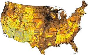
Soil is one of the basic resources that we have when beginning to work with land. Along with water, climatic patterns, and existing ecosystems, soils form the canvas on which we paint our agro-ecological life support systems.
In the US the Web Soil Survey (WSS) managed by the US Department of Agriculture’s Natural Resource Conservation Service operates one of the largest soil resource information systems in the world.
Soils of more than 95% of the counties in the continental United States have been mapped as part of the National Cooperative Soil Survey. That data is available online through an easy to use map-interface, and a wide range of data is freely available for download as a (well formulated) PDF or as tabulated and spatial data for Geographical Information Systems (GIS) program.
In this article I’ll show you how to navigate the WSS interface, and where to find soil data which is most relevant for initial site assessments for permaculture design. --> Full Article: Getting Soil Data from the USDA Web Soil Survey


No comments:
Post a Comment